News Summary
Kentucky residents should prepare for a significant drop in temperatures as a cold front approaches this weekend. Rain and possibly storms are expected before the transition to snow, particularly in central and northern parts of the state. The winter storm is set to hit on Monday night, with accumulations of snow expected in the north and flooding risks in the south. City preparations are in place for public safety, with emergency plans being activated to assist those in need amid the wintry conditions.
Winter Weather Alert: Kentucky Brace for a Chilly Week Ahead
Residents of Kentucky, get ready to bundle up as a powerful cold front is rolling in this Saturday night. As temperatures plunge, we can expect some gusty showers and possibly a few storms before the cold air sets in. Are you prepared for what Mother Nature has in store this week? Let’s break down the forecast!
Temperature Drop and Rainy Days
On Sunday, the temperatures are projected to struggle their way up to the low 40s, so a cozy sweater or warm jacket might be your best friend. It’s going to be a chilly weekend, paving the way for the first of several wintry weather events.
This Week’s Winter Storm Forecast
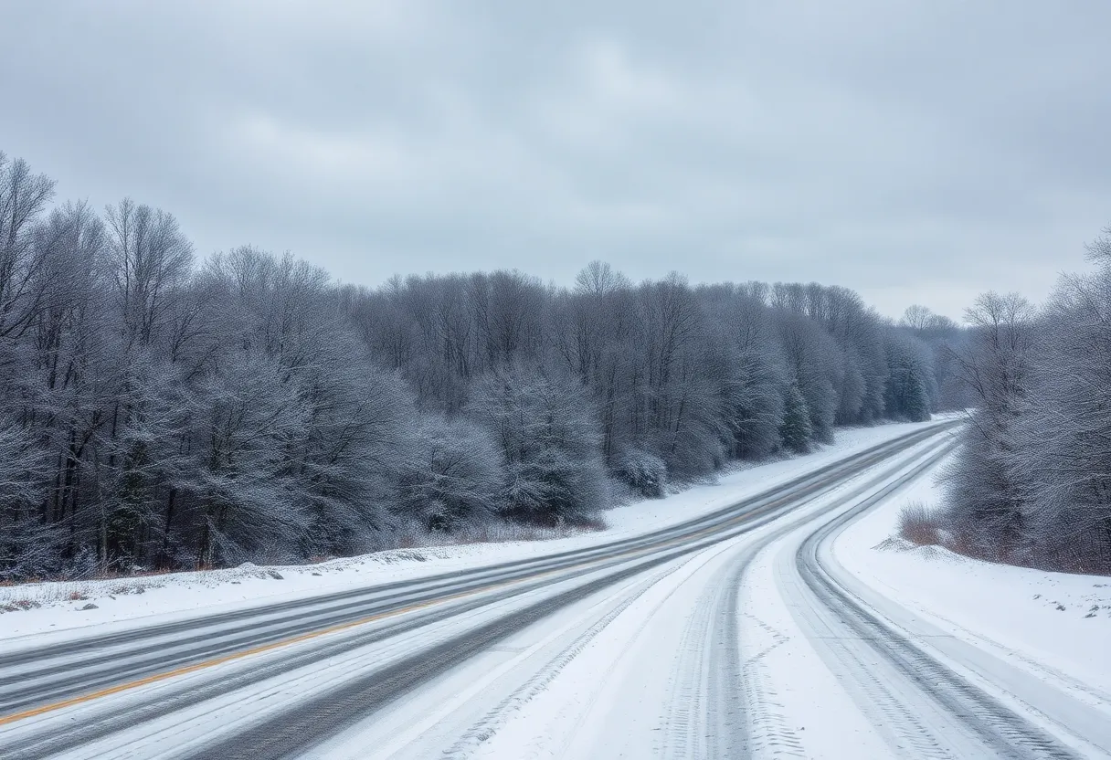
The real action kicks off Monday night as a winter storm is forecasted to impact the area. It looks like we’ll see a mix of precipitation that will significantly affect travel and outdoor activities. Central and northern Kentucky are likely to receive accumulations of snow, while those further south will primarily experience rain.
Specifically, snow is expected to form along and north of the I-64 corridor. If you live in these areas, keep an eye on the forecast as temperatures are expected to hover near or below freezing. Early Tuesday may bring heavy snow, especially in regions between the I-64 corridor and the Cumberland and Hal Rogers parkways. However, as temperatures rise later in the day, this white stuff will likely change over to rain.
Snow Accumulations and Flooding Risks
For those braving the elements north of the parkways, snow accumulations seem increasingly likely. Current forecasts suggest a possibility of anywhere from 1 to 3 inches, with even higher amounts possible in a narrow band.
But while folks in the north are shoveling snow, the southern parts of Kentucky are facing another concern: flooding. With another inch or two of rainfall expected, creeks and streams, already swollen from recent precipitation, pose a heightened flooding risk through the week. So, everyone in those areas should remain vigilant.
More to Come: A Second System Approaches
Just when you thought it was safe, another storm system is expected to make its entrance on Wednesday night into Thursday! This one could bring a fresh mix of rain and wintry weather, keeping residents on their toes. And if that’s not enough, forecasters are eyeing yet another system that could potentially impact the region next weekend. It looks like the winter weather isn’t done with us yet!
City Preparations and Safety Measures
In light of the impending winter weather, officials in Lexington are taking significant measures to ensure public safety. Snow emergencies are being extended, and the city is operating under 24-hour operations for public safety divisions. Residents are encouraged to avoid parking on snow emergency routes to facilitate quick street clearing.
With approximately 6,200 tons of salt on hand, crews are actively pretreating high-priority roads. While the snow emergency remains in effect, delays may occur in sidewalk clearing ordinances for residents. Additionally, the city’s waste management has temporarily suspended recycling and yard waste pickups due to the severe weather, continuing trash collection only for the remainder of the week.
Emergency Plans in Place
An emergency winter weather plan is also now operational, with local shelters offering overflow beds and essential supplies for those in need. Community outreach efforts are ramping up, ensuring that everyone is taken care of during this wintery spell.
As the local National Weather Service continues to monitor the situation and provide updates, it’s crucial for residents to stay informed and remain “Weather Aware.” Conditions may change rapidly, so let’s all do our best to stay safe and prepared during this chilly week in Kentucky!
Deeper Dive: News & Info About This Topic
HERE Resources
Kentucky’s Recent Leadership Changes Signal Growth
Winter Woes in Lexington: Snow Removal Costs Skyrocket
Winter Storm Blair Dumps Heavy Snow Across Kentucky
Record-Breaking 70°F Weather in Lexington on February 3rd
Fayette County Schools Declare Non-Traditional Instruction Day
University of Kentucky Announces Two-Hour Delay Due to Winter Weather
Fayette County Schools to Reopen on March 14
Heavy Snowfall Increases Deer Sightings on Kentucky Interstates
Fayette County Schools Set Makeup Day for March 14
Winter Chill Brings Respiratory Illness Surge in Kentucky
Additional Resources
- Kentucky.com: Winter Weather Alert
- Wikipedia: Winter Weather
- LEX18: Lexington Prepares for Winter Weather
- Google Search: Winter Weather Kentucky
- Fox56 News: Winter Storm Update
- Google Scholar: Winter Weather News
- Kentucky.com: Winter Storm Forecast
- Encyclopedia Britannica: Winter Storm
- LEX18: Be Ready Lexington
- Google News: Kentucky Winter Storm
- Fox56 News: Winter Weather Tomorrow